Why Sammamish River Flooding Isn’t the Same in Every Neighborhood
When news stations announce “Sammamish River flooding,” my neighbor in Redmond rushes to sandbag his basement while my friend in Kenmore barely looks up from her coffee. Same river, same storm—completely different experiences.
After watching five different neighborhoods handle the December 2025 floods in five completely different ways, I finally understood something critical: where you live along the river’s 14-mile path determines everything about your flood risk.
Your warning time. Your water velocity. Your drainage timeline. Even whether you need flood insurance at all.
This isn’t some minor variation. We’re talking about having three days to prepare versus three hours. We’re talking about water gently pooling versus debris-laden torrents slamming into structures.
Let me show you what I learned about how Sammamish river flooding changes every few miles along the corridor.
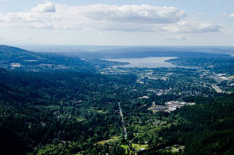
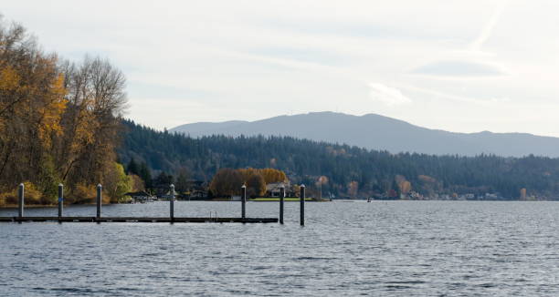
The Lake Sammamish Outlet: Where Everything Begins
Stand at Marymoor Park and watch the river’s birth. Water flows from Lake Sammamish through a 1,400-foot transition zone controlled by a concrete weir. This spot determines flood behavior for the entire 14-mile system downstream.
Properties near the lake outlet flood differently than anywhere else along the river. Your risk doesn’t come from the river overflowing, it comes from Lake Sammamish itself rising like a bathtub that won’t drain fast enough.
The lake collects water from a massive 62,080-acre watershed. Issaquah Creek, Tibbetts Creek, and Laughing Jacobs Creek all feed into Lake Sammamish. When atmospheric rivers hit, this enormous volume of water concentrates at one narrow outlet.
And here’s the problem: the weir can’t be adjusted. There’s no control valve. No emergency override. Water escapes at the rate the concrete structure allows, period.
Sammamish river flooding at the lake outlet gives you the most warning time, sometimes days as you watch lake levels slowly climb. But once flooding starts, it lasts the longest because the entire lake needs to drain through that single outlet.
If you own property near Marymoor, forget about watching downstream river gauges. Subscribe to USGS gauge 12122000 for Lake Sammamish water levels. That’s your early warning system.
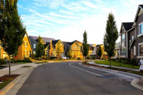
Redmond: Where Urban Meets Agriculture
Three miles downstream, Sammamish river flooding transforms completely.
Redmond sits in a transition zone where urban development meets the wide agricultural valley. The river valley here spreads more than a mile wide in places, with Willows Run Golf Course occupying much of the floodplain.
This is where I learned that flooding can happen even when the river looks fine.
My cousin lives four blocks from the river in Redmond. His basement flooded during the December 2025 storms even though the river never visibly overflowed its banks near his house. How?
Stormwater backflow.
When Sammamish river flooding raises river levels, the city’s stormwater outfalls can’t drain. Water that should flow away from your property backs up through the drainage system instead. You get flooded from below, not from obvious overland flow.
King County identifies Northeast 95th Street and sections of the Sammamish River Trail as vulnerable access routes. When these flood, entire neighborhoods can become isolated.
Bear Creek joins the Sammamish River in Redmond from the east. When both waterways flood simultaneously—which happens more often than you’d think—the compound effect pushes water into areas that would stay dry during single-source events.
Redmond residents need to understand you face multi-directional threats: river overflow, stormwater backup, tributary flooding, and urban runoff that can’t drain. Your emergency plan needs to account for all four.
The Agricultural District: What Flood Control Was Actually Built For
Between Redmond and Woodinville stretches the wide, flat Sammamish Valley Agricultural Production District. This zone is why federal flood control infrastructure exists at all.
Congress authorized the 1965 flood control project specifically to protect these farms during spring planting. When farmland here floods, it’s often the system working within design parameters, not failing.
The Farmland Preservation Program protects this area from development, maintaining its agricultural character. That means when Sammamish river flooding occurs here, water spreads across fields rather than impacting dense residential areas.
But if your home borders the agricultural district, you face a unique challenge.
When those fields flood, water sits for days or weeks. The flat topography provides nowhere for drainage. River levels need to drop significantly before the land can drain, and groundwater tables stay elevated long after visible surface water disappears.
Your basement stays damp. Moisture creeps into crawl spaces. Mold growth accelerates in the prolonged humidity even if you never saw visible water in your house.
The Sammamish River Trail through this zone floods predictably. Smart residents use trail flooding as an early warning system—if the trail’s underwater, prepare your home immediately. The wide valley gives you more warning time than narrower sections downstream.
Woodinville: Where the Valley Narrows and Danger Concentrates
Everything changes as the river reaches Woodinville.
The wide agricultural valley suddenly constricts. The river turns sharply from north to northwest, then west. Development intensifies. And Sammamish river flooding becomes concentrated and dangerous.
Remember how the agricultural district spreads water across a mile-wide valley? Woodinville forces all that water through a much narrower channel. When the river exceeds capacity here, flooding impacts developed areas directly rather than spreading harmlessly across farmland.
Water velocities increase. Debris loads concentrate. Structural damage risk jumps significantly.
Little Bear Creek joins from the north in Woodinville, adding another variable. When this tributary peaks simultaneously with the main river, flooding escalates faster than in the wider valley upstream.
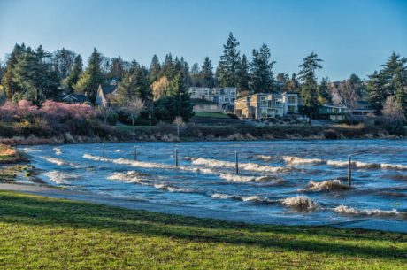
I watched my friend in Woodinville go from dry property to two feet of water in her garage in under four hours during December 2025. Meanwhile, properties in the agricultural district had days of warning as water slowly spread across fields.
Woodinville has invested in bridge improvements designed to divert floodwater away from developed areas. These help, but they haven’t eliminated the risk—they’ve just reduced it. Property values and flood insurance rates near bridges reflect this evolving but still-present danger.
If you live in Woodinville, accept that you have hours not days to respond when flood warnings issue. Have your emergency plan completely ready before flood season starts, because you won’t have time to figure it out mid-crisis.
Bothell: Cumulative Watershed Impact Hits Hard
By the time Sammamish river flooding reaches Bothell, the river’s carrying water from everywhere upstream: Lake Sammamish, Issaquah Creek, Bear Creek, Little Bear Creek, and now North Creek joining near the UW Bothell campus.
Your flood risk here reflects the entire watershed’s behavior. Heavy rain at Lake Sammamish 14 miles away affects your Bothell property hours later. This cumulative effect means floods develop quickly and carry accumulated debris from miles upstream.
Bothell has invested heavily in riverbank restoration and stabilization. Many city parks feature improved landscaping and bank replanting that enhances both ecology and flood resilience.
But even with improvements, the 2018 Sammamish Bank Repairs near the I-405 overpass had to address serious riverbank damage threatening the trail. The erosive force of 12+ miles of flowing water concentrates at this lower valley position.
Park at Bothell Landing floods regularly—the amphitheater fills with water during significant events. When the park floods, adjacent properties should be on highest alert. Local officials noted that recent flood heights exceeded anything older residents remembered seeing.
North Creek’s watershed north of Bothell adds substantial flow. Properties near the confluence face bidirectional flood threats, water can come from both the main river and the tributary simultaneously.
Bothell residents should understand you’re flooding from a river carrying debris, sediment, and potential contamination from 12+ miles upstream. Professional restoration often reveals more extensive contamination than in upstream zones, requiring comprehensive Category 3 water damage protocols.
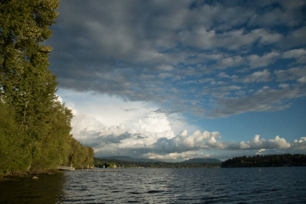
Kenmore: The Final Bottleneck to Lake Washington
The river’s final two miles tell a different flooding story entirely.
Kenmore sits between two lakes—Lake Sammamish upstream and Lake Washington downstream. While the Ballard Locks control Lake Washington levels, high lake levels can slow the Sammamish River’s ability to drain, backing water up into Kenmore.
Swamp Creek joins from the north here, and local residents have long argued it needs dredging. Properties along 73rd Avenue Northeast experience flooding that’s partially independent of main river conditions. When Swamp Creek can’t drain into the Sammamish River due to high river levels, localized flooding worsens.
The December 2016 winter storm hit Kenmore hardest among Northshore communities. Sandbags were in high demand at five locations around the city. Properties along 73rd Avenue Northeast north and south of Northeast 192nd Street received particular attention.
Sammamish river flooding in Kenmore develops relatively slowly but lasts the longest. You’re at the system’s end—the lowest point where all upstream water must drain through. Even after Redmond and Woodinville are drying out, Kenmore properties may remain flooded as accumulated water from 14 miles upstream works through the final bottleneck.
Landslide risks compound flooding problems here. The December 2016 event included concerns about slopes threatening roadways near Arrowhead Drive and Northeast 61st Place.
Evacuation routes are more limited than upstream communities. Flooded roads can quickly isolate neighborhoods, making advance preparation absolutely critical. Have multiple days of supplies ready, not just 24-48 hours.
What Your Specific Location Means for Your Home
If you’re near Lake Sammamish, monitor lake levels not downstream river conditions. You have the most warning time but the longest flood duration.
In Redmond, understand that flooding can happen from stormwater backup even when the river looks fine. Know where your property drains and install backflow preventers if possible.
Along the agricultural district, use the Sammamish River Trail as your early warning system. When it floods, you have hours to prepare, use them.
In Woodinville or Bothell, fast action is critical. You have minimal warning time. When watches are issued, act immediately.
In Kenmore, prepare for the longest flood duration of any zone. Plan for extended periods without normal services or access.
FAQ: Neighborhood-Specific Flooding Questions
Q: Does my flood insurance cover my specific area’s flood type?
Standard policies may not match your area’s unique flooding patterns. Redmond properties need coverage for stormwater backup. Woodinville needs protection against debris damage. Review your policy using these geographic insights.
Q: Should I buy flood insurance outside FEMA zones?
Yes. FEMA maps don’t capture the geographic nuances described here. Redmond homes flood from stormwater backup even outside river floodplains. Kenmore homes flood from Swamp Creek independent of the main river.
Q: How do I know which zone I’m in?
Check proximity to landmarks: near Marymoor (lake outlet), Redmond city center to Woodinville with farms (agricultural district), near I-405 (Bothell), or near Lake Washington outlet (Kenmore).
Q: Why does my neighbor flood when I don’t?
Elevation differences of just 2-3 feet matter enormously. Proximity to tributaries, stormwater connections, and micro-topography create different experiences for houses on the same street.
Q: Can upstream development cause more flooding downstream?
Yes. Development in Redmond affects stormwater runoff that impacts Woodinville and Bothell. Agricultural practices in the production district influence drainage throughout the system. The entire watershed is connected.
Q: What’s the worst location for flooding along the river?
There’s no single “worst” spot—each location has unique challenges. Lake outlet has longest duration. Woodinville has highest velocities. Kenmore has slowest drainage. Your “worst” depends on which flood characteristic matters most to your situation.
Q: How accurate are river level predictions for my neighborhood?
Predictions work better for some zones than others. Lake outlet predictions are fairly reliable. Compound flooding zones like Woodinville and Bothell are harder to predict due to tributary contributions. Always err on the side of caution.
When Your Neighborhood Floods: PuroClean of Renton Responds 24/7
Understanding how Sammamish river flooding varies by location helps you prepare. But when water’s actually in your home, you need professional help immediately.
PuroClean of Renton provides 24/7 emergency water damage restoration throughout every zone of the Sammamish River corridor. We understand that lake outlet flooding requires different treatment than Woodinville debris-laden floods or Kenmore’s contamination from 14 miles upstream.
Our certified technicians arrive within 60 minutes with industrial-grade extraction equipment, commercial dehumidifiers, and EPA-approved antimicrobial treatments. We don’t just remove water, we prevent the mold growth that starts within 24 hours and can cost tens of thousands in additional damage.
We handle Category 3 water damage from river flooding using specialized protocols. Our team manages everything from emergency extraction through complete reconstruction, working directly with your insurance company to streamline claims.
Whether you’re at the lake outlet in Redmond, the agricultural district, Woodinville’s narrow valley, Bothell’s confluence zone, or Kenmore’s final bottleneck, PuroClean of Sammamish knows your neighborhood’s specific flood characteristics and responds accordingly.
Don’t wait for water in your basement to find help. Call PuroClean of Sammamish now at (425) 947-1001 for a free property flood risk assessment. We’ll evaluate your specific location’s vulnerabilities, recommend protective measures, and ensure you’re ready when Sammamish River flooding strikes your neighborhood. Available 24/7/365—because flooding doesn’t wait for business hours.
Available 24/7/365 | (425) 947-1001 | Contact Us Online | Google Business Profile | IICRC Certified | True Emergency Response | Complete Damage Restoration Solutions