Categories are more than numbers. Learn the science of storm intensity levels, how hurricanes like Erin shift in strength, and what this means for preparedness.
When hurricanes threaten our communities, the first thing most people notice is the “category.” But hurricane levels are more than just numbers—they represent the science of wind speeds, pressure, and evolving conditions. Hurricane Erin, the first major storm of the 2025 season, has shown us how unpredictable these systems can be. By looking at the science of strength scales, we can better understand what they mean, why they change, and how to prepare for their impact.
The Science of Classifications
Hurricanes are classified using the Saffir-Simpson Hurricane Wind Scale, which ranks them into Categories 1 through 5 based on sustained wind speeds. But here’s the key: this scale only measures wind, not flooding, storm surge, or rainfall. That’s why a “weaker” storm on paper can still cause devastating damage.
- Category 1 (74–95 mph): Some roof, siding, and tree damage possible.
- Category 2 (96–110 mph): Extensive roof and powerline damage, longer outages.
- Category 3 (111–129 mph): Considered a major hurricane, with widespread outages and infrastructure damage.
- Category 4 (130–156 mph): Catastrophic damage, structural failures, weeks-long recovery.
- Category 5 (157+ mph): Complete roof collapse and long-term displacement likely.
Understanding the science of scales reminds us that a hurricane’s number doesn’t tell the whole story.
Hurricane Erin’s Example
Hurricane Erin formed off Cabo Verde on August 11, 2025 and rapidly intensified into the season’s first major hurricane. At its peak, Erin reached Category 5 with 160 mph winds and a central pressure of 915 mb (Reuters).
However, Erin didn’t stay at one strength. On August 16, it weakened to Category 3 during an eyewall replacement cycle—a process where the inner eyewall collapses and is replaced by a larger one. Afterward, it quickly regained Category 4 intensity. This back-and-forth demonstrates how hurricane rankings can fluctuate even in a matter of hours.
Why Hurricane Rankings Change
The science of strength scales is rooted in atmospheric dynamics. Hurricanes change designations due to:
- Eyewall Replacement Cycles – Temporary weakening followed by re-strengthening, as Erin showed.
- Sea Surface Temperatures – Warm waters fuel storms; cooler waters reduce their energy.
- Wind Shear – Crosswinds at altitude can disrupt circulation.
- Land Interaction – Even brief contact with islands can weaken a storm.
For property owners, this means never assuming a storm will remain at the same level throughout its approach.
Beyond the Category: Erin’s Impacts
Erin has already left destruction across regions, regardless of its official category:
- Cabo Verde: The storm’s precursor caused catastrophic flooding, killing at least nine people and displacing thousands (Wikipedia).
- Puerto Rico: Outer bands knocked out power to 147,000 customers, highlighting that impacts extend far beyond a storm’s center (The Guardian).
- U.S. East Coast: North Carolina’s Dare County declared a state of emergency and ordered evacuations even though Erin isn’t expected to make landfall (News Observer).
- Rip Currents & Surf: Dangerous swells are forecast from the Outer Banks to Delaware and New Jersey (Fox 29).
These events prove that intensity levels don’t capture the full range of risks. Flooding, storm surge, and power loss can occur even at lower categories or outside the projected path.
Lessons for Property Owners
1. Don’t Depend on the Number Alone
Erin’s shifts between Category 3, 4, and 5 didn’t change the fact that it created life-threatening conditions across multiple regions.
2. Watch for Secondary Hazards
Storm surge, rainfall, and flooding are not measured by the Saffir-Simpson scale but often cause the most damage.
3. Prioritize Preparedness
An Emergency Management Plan (EMP) can save critical time and reduce losses. At PuroClean of Aventura, Davie, Downtown Miami, and East Orlando, we design custom EMPs with shut-off maps, checklists, and pre-authorization for work, so your team knows exactly what to do when every minute counts.
Hurricane Preparedness Tips
When a storm is on the horizon, preparation makes all the difference. Simple steps like securing outdoor furniture, stocking emergency supplies, reviewing your property’s Emergency Management Plan, and knowing evacuation routes can help protect both lives and property.
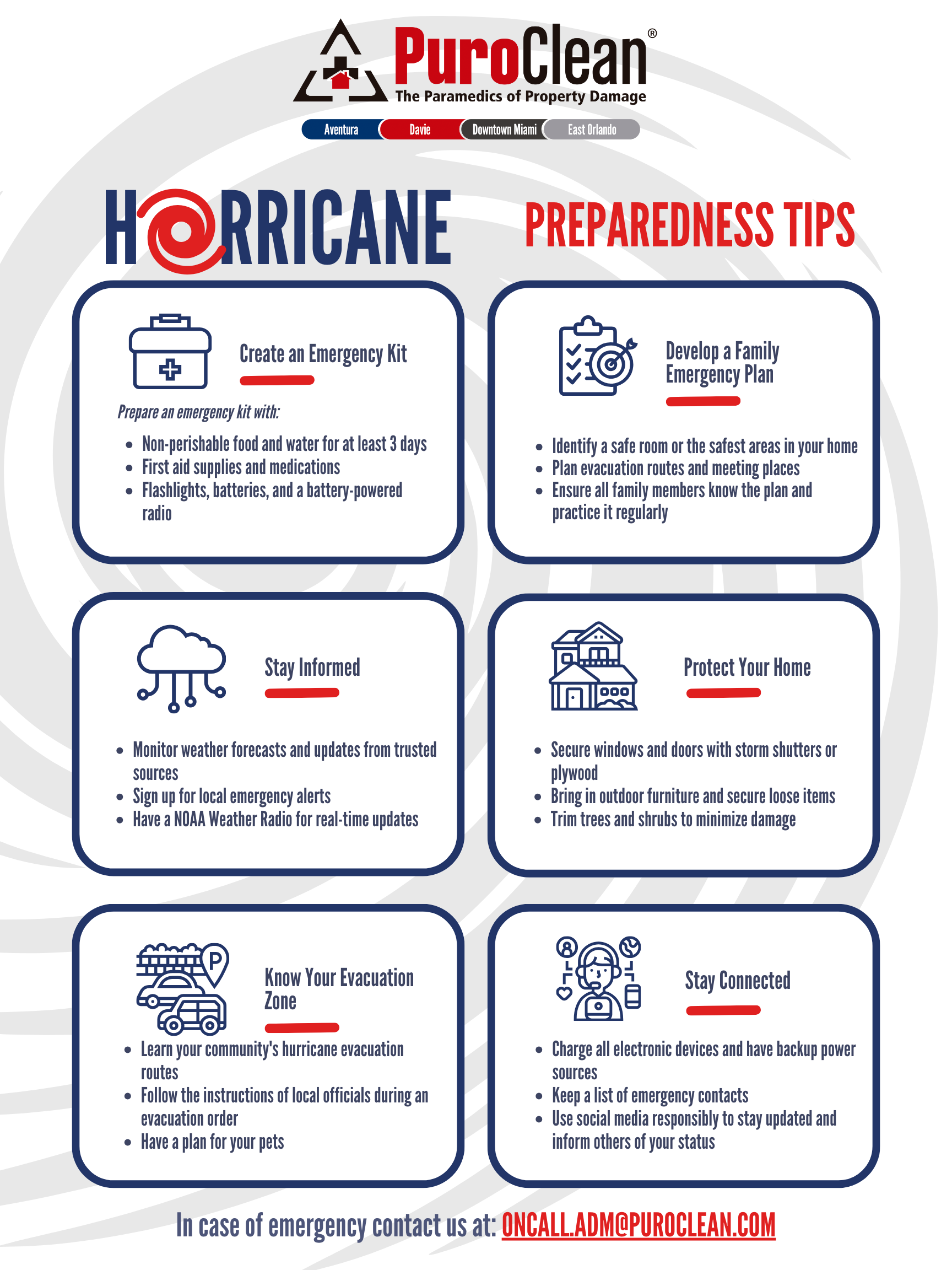
When a storm is on the horizon, preparation makes all the difference. Simple steps like securing outdoor furniture, stocking emergency supplies, reviewing your property’s Emergency Management Plan, and knowing evacuation routes can help protect both lives and property.
PuroClean’s Role During Hurricanes
When hurricanes strike, our team provides:
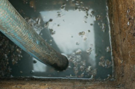
- Water Damage Restoration – From storm surge or roof leaks.
- Mold Remediation – Preventing growth after flooding.
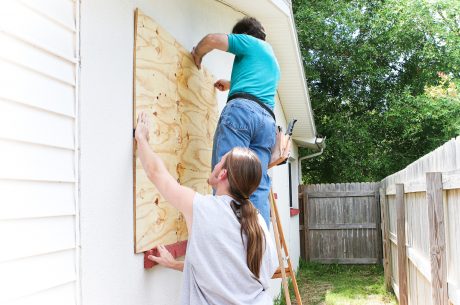
- Emergency Board-Up & Stabilization – Securing your property against further damage.
- Biohazard Cleanup – Handling contamination in floodwaters.
Through our Customer Loyalty Program (CLP), clients receive priority service, free estimates, and a $3,000 credit, ensuring fast recovery when disaster hits.
Final Word on Hurricane Stages
Hurricane Erin is a reminder that classifications are not the whole story. The science of severity levels helps explain wind speeds, but the true danger often lies in flooding, surge, and the storm’s unpredictable path.
For South Florida property owners, the takeaway is simple: don’t wait for a storm to change rankings before preparing. Partner with trusted professionals like PuroClean of Aventura, Davie, Downtown Miami, and East Orlando to protect your property, plan ahead, and recover quickly.