For immediate Disaster Response call: (800) 775-7876
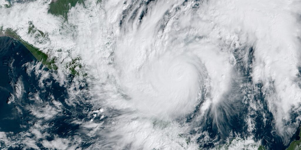
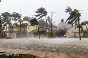
Hurricane Eta made landfall in Nicaragua as a category 4 hurricane on November 3 bringing major devastation in its wake. According to the U.S. National Hurricane Center, Eta had sustained wind speeds of 105 mpg at the time of landfall, dropping off from the recorded high of 165mph just one day prior. A 12-year-old girl died in a mudslide in San Pedro Sula, the main population center in northern Honduras. Thousands are currently displaced and are dealing with flooding and power outages.
Eta wore down its strength to be a Tropical Depression. However, it is expected to move off of Central America and into the warmer waters of the Caribbean Sea, where it is anticipated that it will start to rebuild its strength. Tropical Storm Warnings have been issued to the Cayman Islands and Tropical Storm Watches are in effect for western and central Cuba. Eta’s current trajectory also projects that the Bahamas and much of southern and western Florida to possibly experience direct hits. Additional watches will likely be issued on Friday, November 6 for parts of the Bahamas, South Florida and the Florida Keys.
Current models suggest that Eta will make landfall with the mainland United States by Sunday, November 8, as either a Tropical or Subtropical Storm. This designation means heavy rainfall is expected with sustained wind speeds of 40mph-65mph. Although forecasts become less certain the farther into the future they try to predict, the possibility exists and could be considered likely that Eta will move into the Gulf of Mexico off of Florida’s west coast and move north into the Florida Panhandle, as well as Alabama, Mississippi, and Louisiana.
Storm Activity
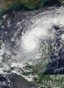
Hurricane Eta is expected to produce the following rainfall amounts through Saturday morning:
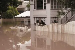
Flash flooding and river flooding will be possible in Cuba, along with landslides in areas of higher terrain. Life-threatening flash flooding will be possible across saturated urban areas of southeast Florida. Flash and urban flooding will also be possible for the Bahamas and the remainder of southern and eastern Florida over the next several days. Minor river flooding is also possible for central Florida.
Every insurance policy is different. You should contact your broker/agent or your insurance company to determine the amount of coverage that you have.
First, contact a water-damage restoration company, such as PuroClean, as soon as possible. Don’t wait, as water can cause mold and irremediable damage to the wood, walls, and carpet in your home. Then, contact your insurance company to start the claim process. If safe, shut off the utilities in your home to avoid further damage. Don’t enter your home if it has suffered structural damage. Don’t walk through floodwater if electricity hasn’t been turned off, and avoid contaminants.
There are many variables that determine whether a flooded home can be saved: the amount of water is one, even more important is the amount of time the water was in/around the home. Every situation is different!
Water damage can occur after natural disasters, such as thunderstorms or hurricanes that cause flooding, from pipe bursts, appliance malfunctions, roof leaks, foundation leaks, septic tank overflows, poor drainage, and more. Flash flooding, pipe bursts, and sewage backups are especially dangerous as they can produce several inches of water in less than a day.
Severe winter flooding impacted Seattle on December 8, 2025. Learn about flood-related risks, black water…
Hurricane Milton was an incredibly powerful and destructive storm, ranking as the second-most intense Atlantic…
On the afternoon of April 26, 2024, a powerful and destructive tornado tore through the…
Hurricane Helene caused widespread flooding across multiple states in September 2024, compounding damage from earlier…


© 2026 PuroClean. All Rights Reserved.
© 2026 PuroClean. All Rights Reserved.
